GIS Mapping
Interactive geographical mapping of medieval Anatolian settlements
Anatolia's Toponymy Atlas
Another vital element of the project is the systematic mapping of settlements from the period.
Mappa Anatolicorum has created a unique Anatolian toponymy map covering the mentioned 1200-1450 time period by collecting the valuable data scattered in primary sources about settlements in the Anatolian geography under a single roof.
Thanks to this innovative map, researchers will be able to quickly and effectively identify the centers where important works were produced in Medieval Anatolia and the settlements most frequently referenced in these works, thus saving significant time in their valuable research processes.
This detailed toponymy map created is also a pioneering work in its field in terms of collecting very small settlement units such as villages and districts in a single map. Thanks to the unique data it provides for a period that extends even before the early 15th century Ottoman tahrir records, the historical adventure of some settlement units, the names they changed under different cultural or power centers can be traced precisely to earlier dates.
GIS Mapping Examples
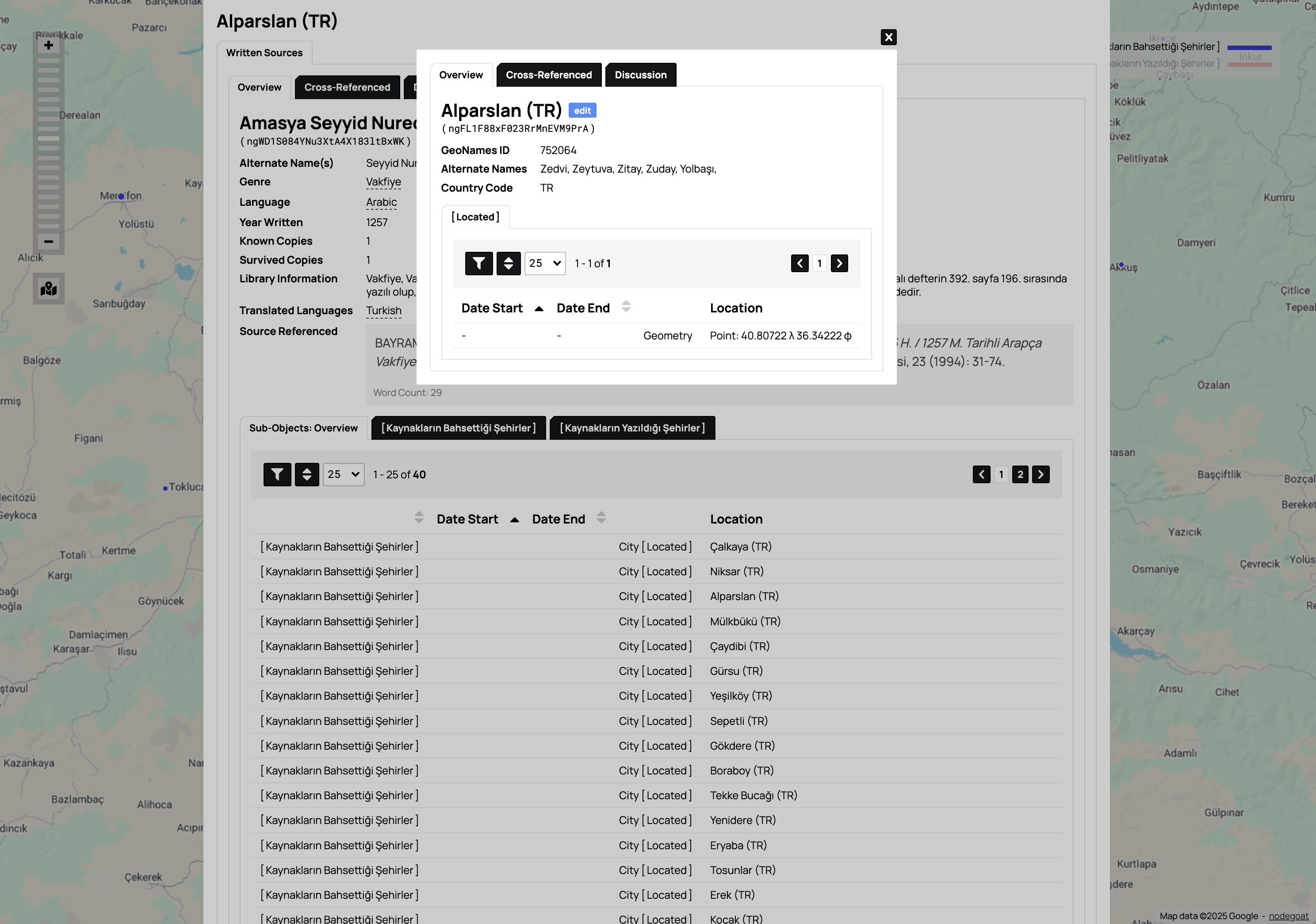
Database Interface for Alparslan — Detailed manuscript database with geographic location data and cross-referenced information
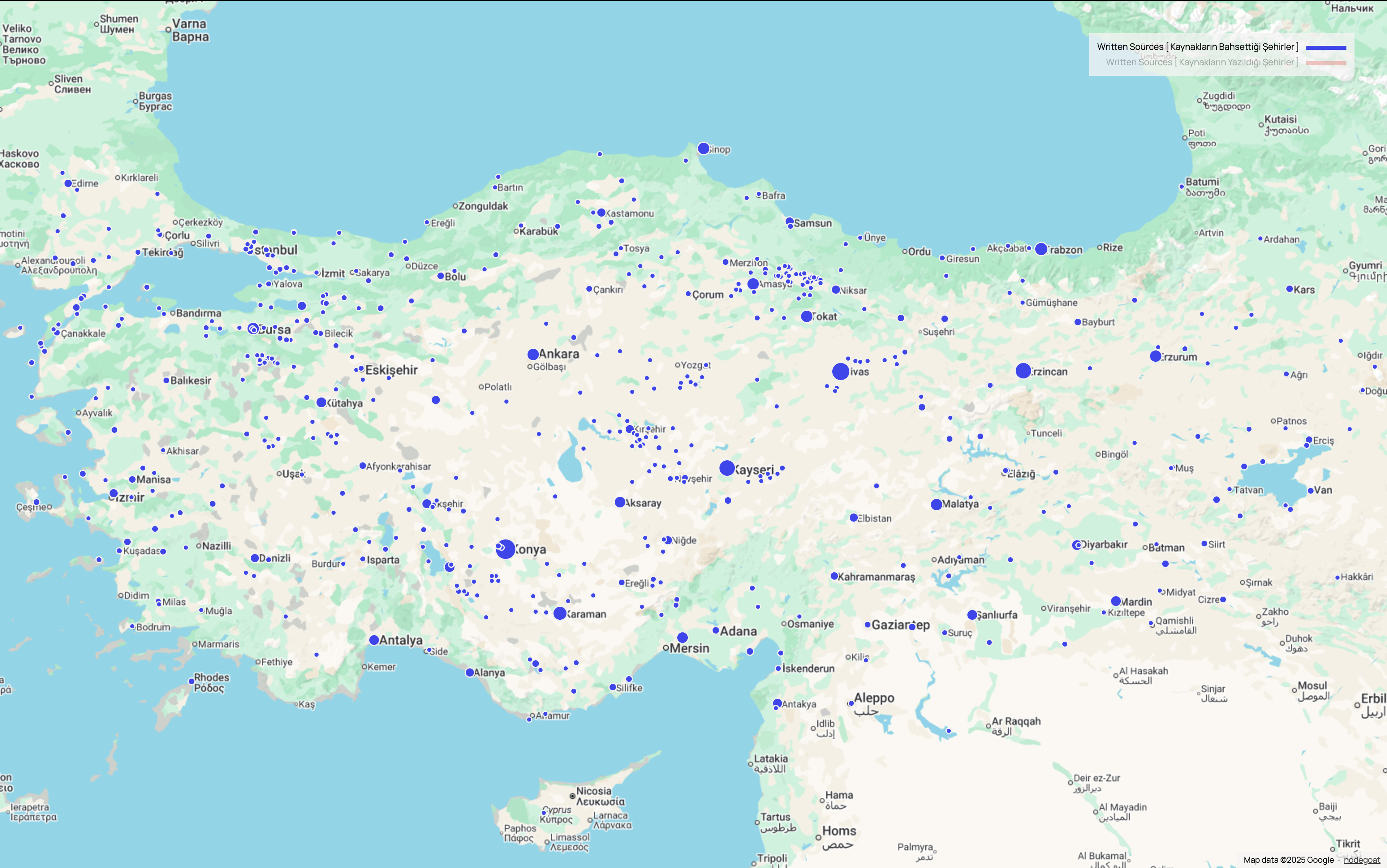
Turkey Overview Map — Geographic distribution of written sources across medieval Anatolian settlements
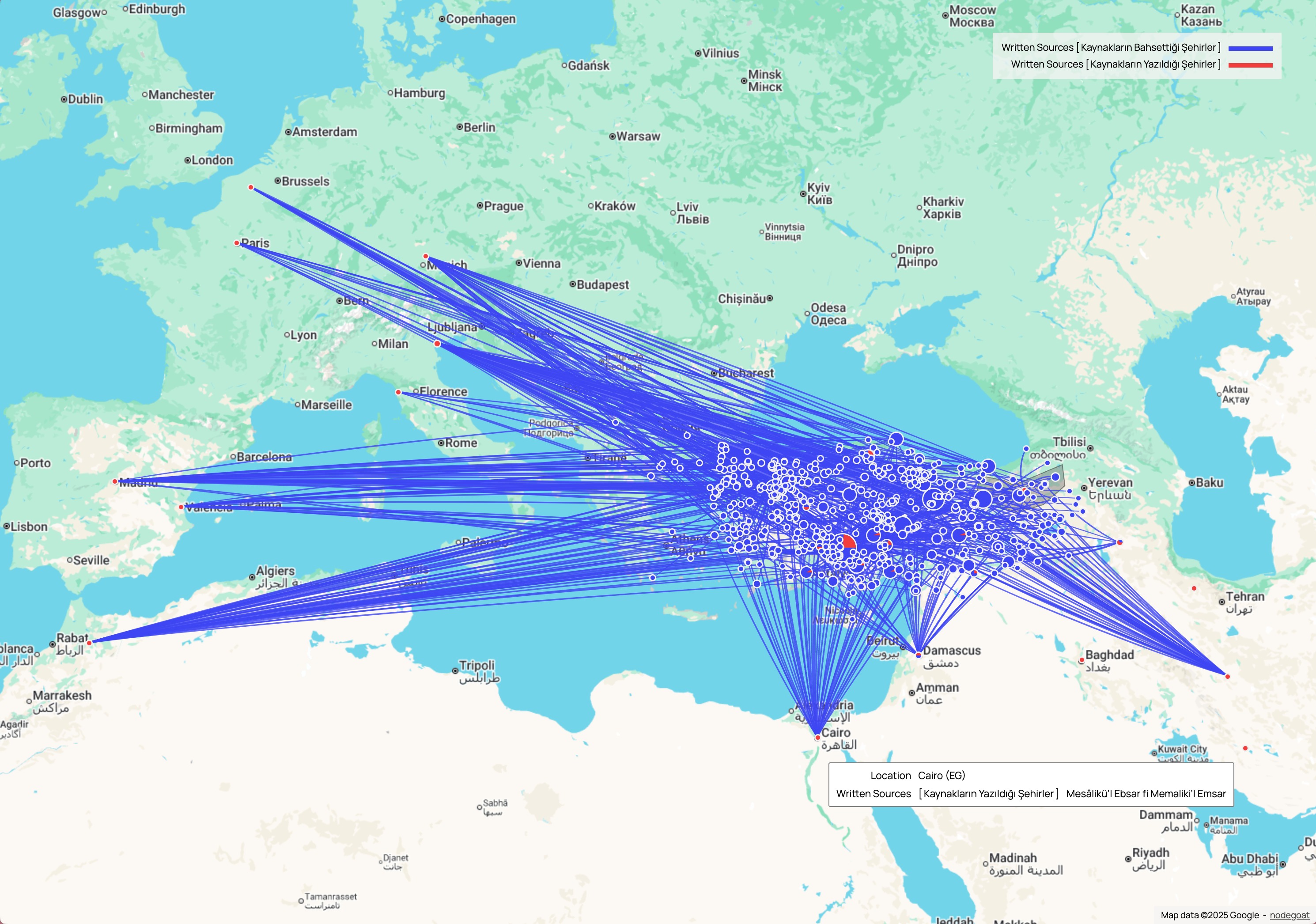
European Network Connections — Historical connections extending from Anatolia to European cities and regions
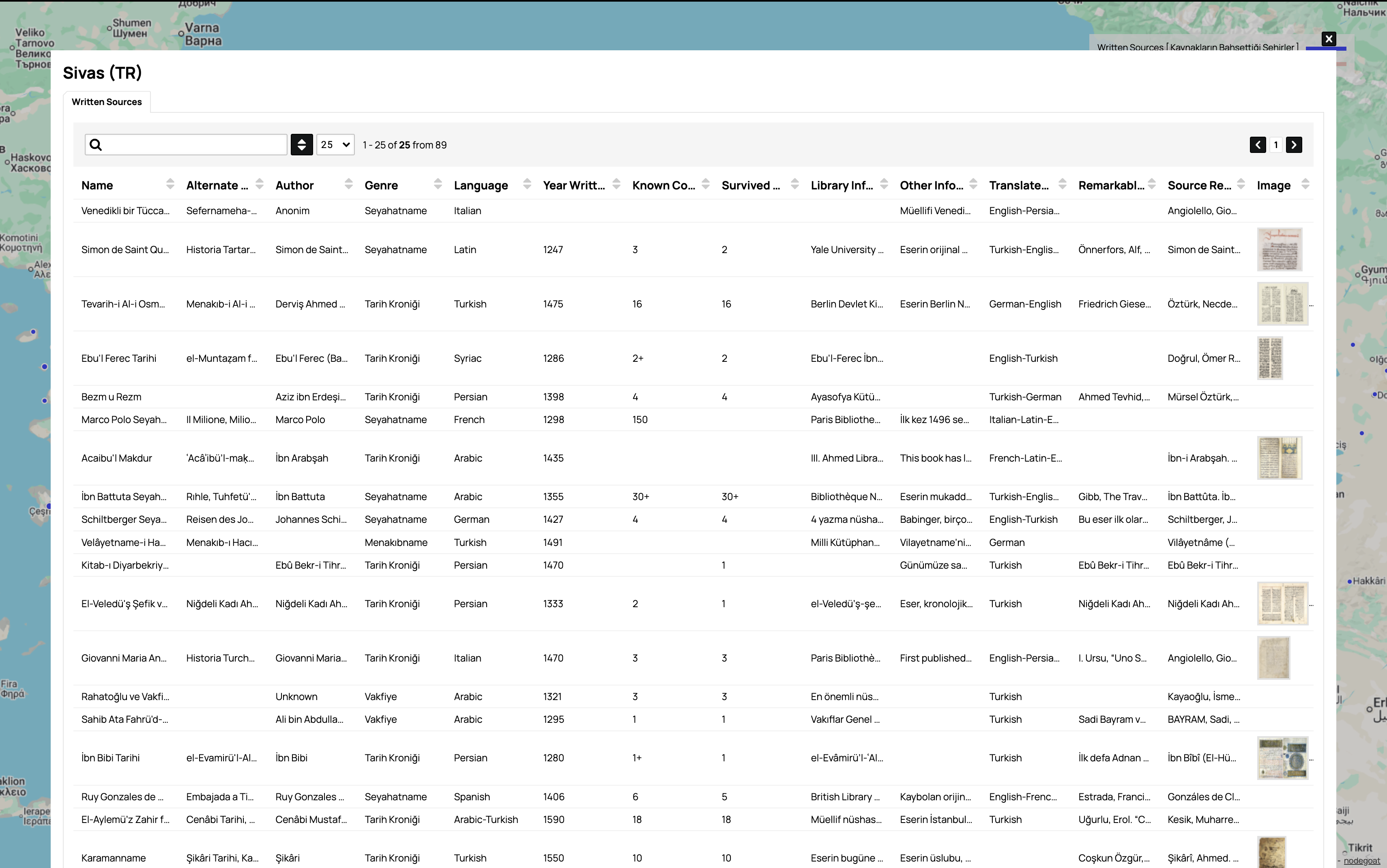
Sivas Data Table Interface — Comprehensive manuscript data table with detailed source information for Sivas region
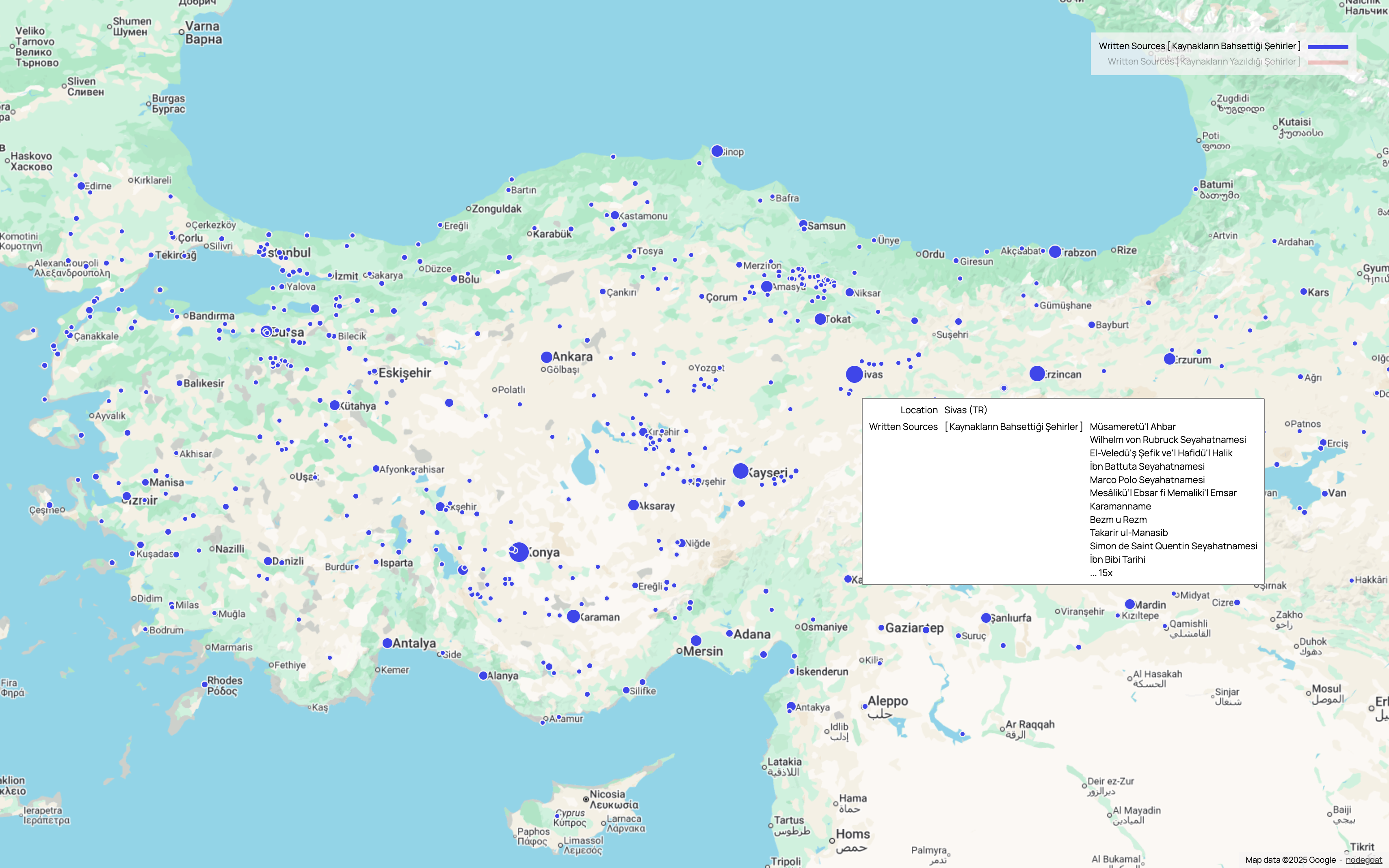
Sivas Location Details — Interactive popup showing written sources and manuscripts associated with Sivas location
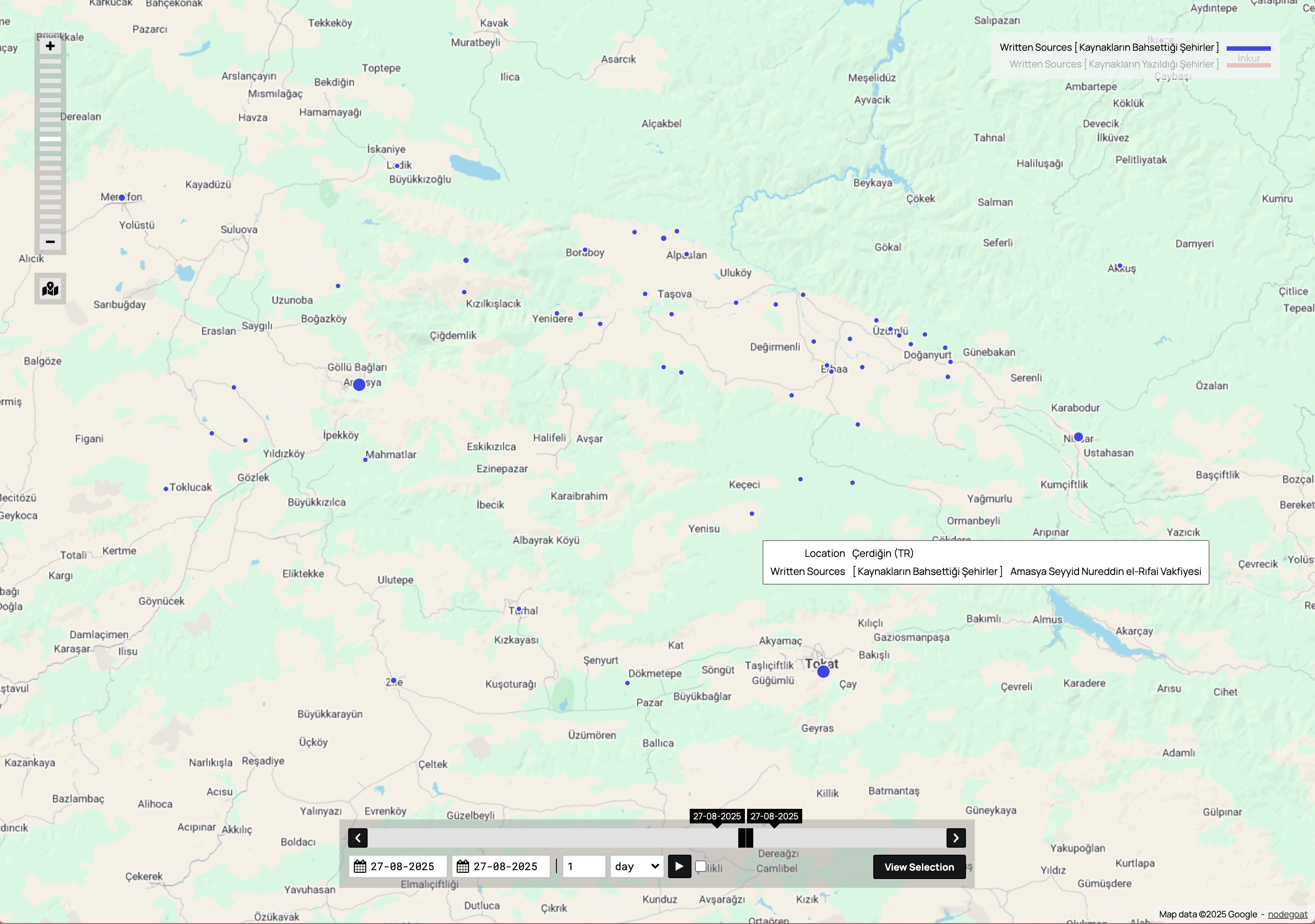
Çerdiğin Timeline Interface — Geographic interface with timeline controls for tracking historical changes over time
Toponymy Atlas
Comprehensive mapping of settlements from 1200-1450
Settlement Tracking
Villages and districts mapped with historical name changes
Interactive GIS
Advanced geographical information systems technology